Figure: Local Display Method
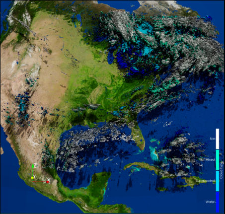
Figure: Paraview Display Method (third party software)
Product Visualization
Current methods of visualizing satellite-derived data are largely two-dimensional. These methods are adequate for depicting large scale cloud features, but lack the ability to depict vertical structure. To address this, we are creating 3D visualization software to capture the missing dimensions of satellite-derived data.
The visualization routines currently support these parameters, which can be used to generate an interactive scene the users can explore 3D data in.
Additionally, we are expanding CIRA's Slider tool to accommodate 3D cloud displays.
Goals:
Click here to see a low resolution example of the Global GEO-Stitch 3D cloud field. It features an interactive zoom and rotatable 3D visualization display but may take a few minutes to load.
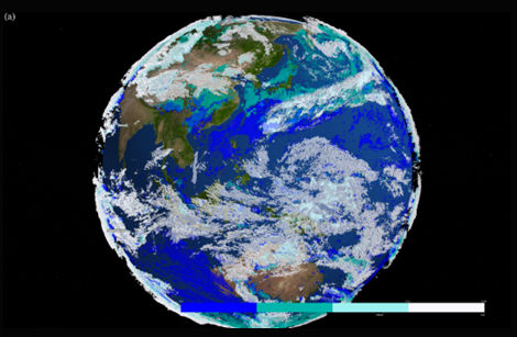
The Global GEO-Stitch 3D Cloud Field covers the whole Earth, colored by cloud type. Water clouds are blue, Supercooled are lightseagreen, Mixed are paleturquoise, and Ice are ghostwhite.
Figure: Local Display Method
Figure: Paraview Display Method (third party software)