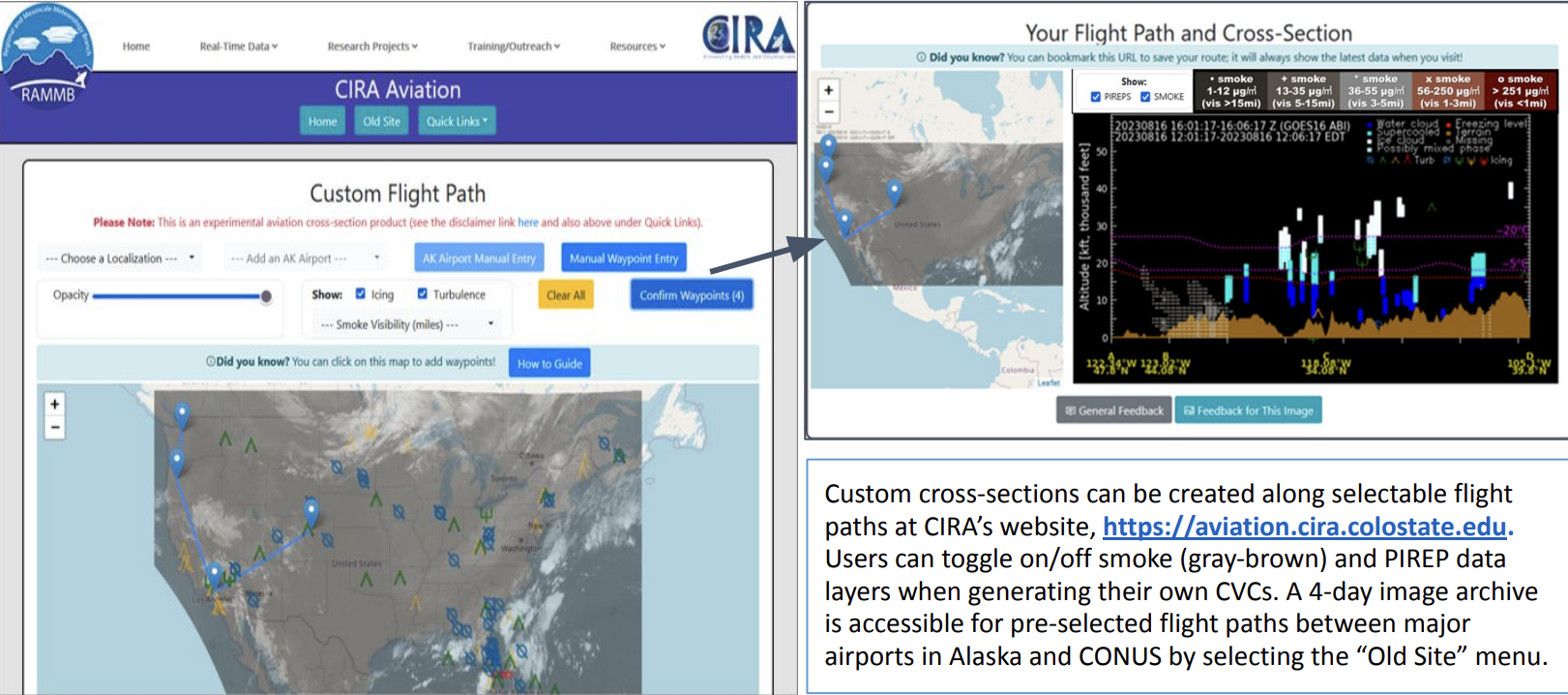
Merging cloud products: We are currently generating gridded 3D cloud data as an experimental product over
selected regions with JPSS VIIRS (Alaska) and GOES-16 ABI (CONUS) data for aviation users.
Multiple 2D cloud products (top/base/phase) with supplementary data such as temperatures and terrain information
are combined into one gridded 3D cloud field using several interpolation methods.
A web-based demonstration tool
with user interfaces to create custom cloud cross-sections is available
on CIRA’s aviation website. See Figure 1 below.
For global 3D cloud data generation, we will start with similar approaches and examine grid spacing methods
including recommendations by ISCCP-NG, which will be adjusted to higher spatial resolution.
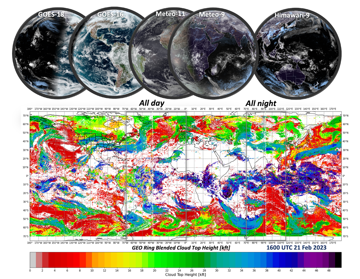
Blending cloud products from multiple sensors with different spatial/time resolutions requires various
corrections for spatial parallax distortion and displacement from cloud motions.
We will explore several blending/interpolation methods to treat transition zones where sensor products overlap
for proper compositing of cloud data, and will investigate more efficient/harmonized merging techniques
including ML/AI for the 3D global cloud data.
These higher-order corrections will provide a higher-quality,
more seamless end-product, as shown below in Figure 2.


